WL White Latitude
Menu
Private polar expedition photography in Antarctic waters

Expedition routes

Two ways into the white continent

These 15-day routes trace a flexible rhythm through Antarctic gateways, wild anchorages, historic harbours, and ice-shaped bays.

Overview

Not a cruise route. A living expedition.

Antarctica changes by the hour. These routes create a premium framework while leaving room for the conditions that make polar travel real: ice, weather, wildlife, and light.

King George Island to Ushuaia

Trip 1 — Fly in, sail south, cross the Drake

15 days

Begin with a flight to the Antarctic gateway, then move deeper through the South Shetland Islands and Antarctic Peninsula before finishing with the legendary Drake Passage crossing.

Fast Antarctic arrivalPeninsula landingsHistoric harboursDrake Passage finale
  1. Day 1

    Welcome in Punta Arenas. Check in.

    Arrival, expedition briefing, and preparation for the flight south.

  2. Day 2

    Flight to Bellingshausen Station, King George Island

    Cross into the Antarctic region and board the yacht near the South Shetland Islands.

  3. Day 2

    Fort Point

    A first landing among volcanic terrain, seabirds, and polar weather.

  4. Day 3

    Yankee Harbour

    A sheltered harbour known for wildlife and gentoo penguin activity.

  5. Day 4

    Half Moon Island

    A crescent-shaped island with dramatic ridgelines and penguin colonies.

  6. Day 4

    Hannah Point

    A wildlife-rich landing where Antarctica feels alive at close range.

  7. Day 5

    Deception Island

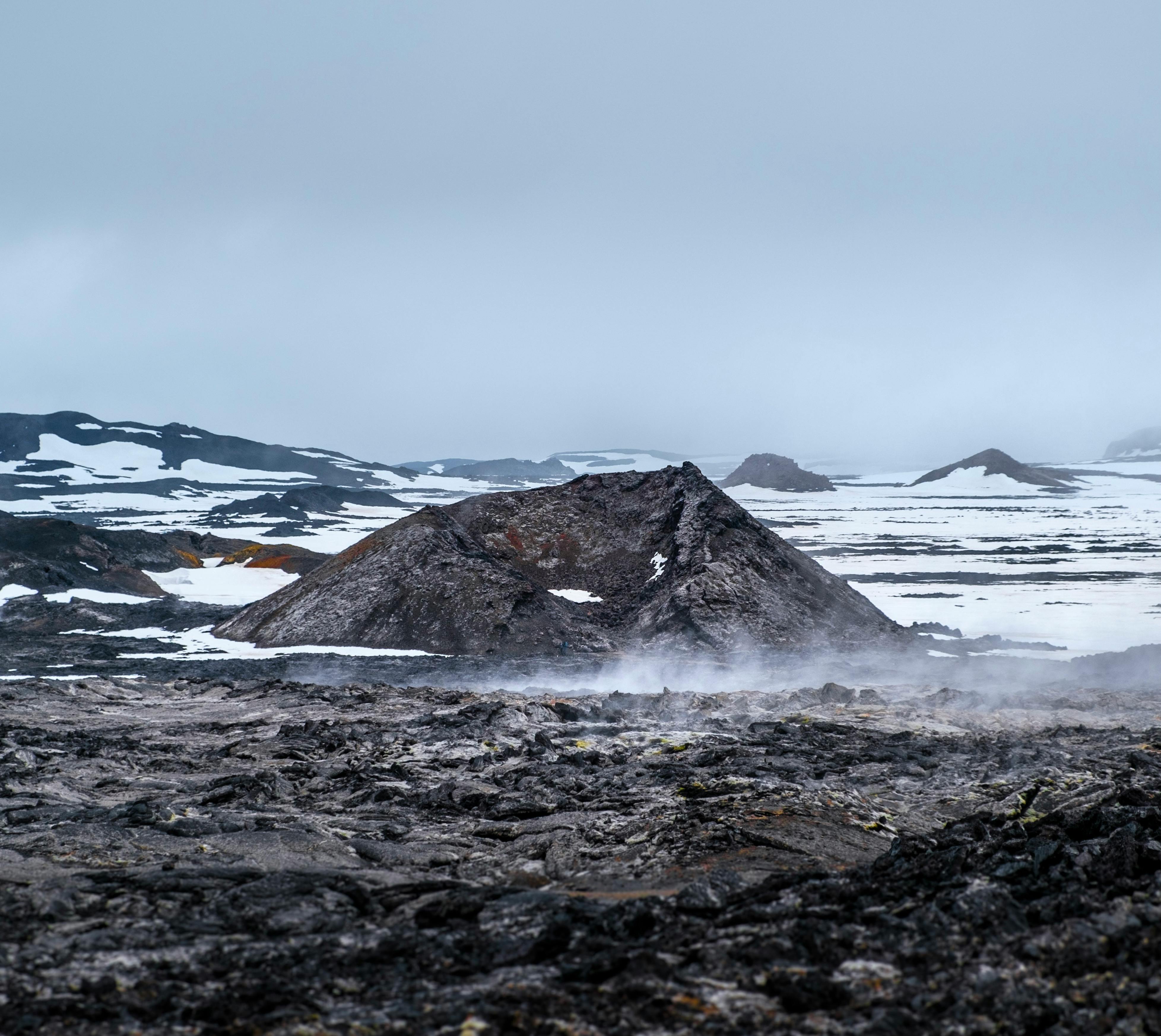
    Enter the flooded caldera of an active volcano, one of the region’s most surreal anchorages.

  8. Day 6

    Mikkelsen Harbour

    Ice, history, and calm water create a classic Peninsula anchorage.

  9. Day 7

    Gouvernøren Harbour, Enterprise Island

    A quiet harbour with traces of Antarctic whaling history.

  10. Day 8

    Cuverville Island

    A major gentoo penguin site backed by mountain and glacier views.

  11. Day 8

    Paradise Bay

    A glacier amphitheatre and one of the Peninsula’s most iconic anchorages.

  12. Day 9

    Port Lockroy

    Historic base, post office, and a rare cultural stop in the polar world.

  13. Day 10

    Hervéou Port, Pléneau Island

    A quiet harbour surrounded by bergs, ice, and photographic light.

  14. Day 10

    Pléneau Point, Pléneau Island

    Explore sculptural iceberg fields and shifting blue-white horizons.

  15. Day 11

    Port Charcot, Booth Island

    A historic expedition site with sweeping views over the Argentine Islands.

  16. Days 12–15

    Crossing the Drake Passage. Ushuaia.

    Sail north across the legendary passage and finish in Ushuaia.
Ushuaia to Punta Arenas

Trip 2 — Sail the Drake, fly out from Antarctica

15 days

Start in Ushuaia with the full ocean crossing, then trace north through the Antarctic Peninsula and South Shetlands before flying from King George Island to Punta Arenas.

Classic Drake approachSouthbound anticipationPeninsula depthFlight out from King George Island
  1. Day 1

    Boarding in Ushuaia

    Step aboard, meet the crew, and prepare for the ocean passage south.

  2. Days 2–5

    Crossing the Drake Passage

    A legendary sea passage and the threshold between the familiar world and Antarctica.

  3. Day 6

    Port Charcot, Booth Island

    A historic polar site and a powerful first contact with the Peninsula.

  4. Day 7

    Pléneau Point, Pléneau Island

    Iceberg fields, sculptural ice, and shifting photographic conditions.

  5. Day 7

    Hervéou Port, Pléneau Island

    A protected harbour with quiet ice views and expedition stillness.

  6. Day 8

    Port Lockroy

    Visit one of Antarctica’s most recognisable historic bases.

  7. Day 8

    Paradise Bay

    Glacier walls, reflective water, and a true Antarctic scale shift.

  8. Day 9

    Cuverville Island

    Penguins, ice, and mountain views in one concentrated landing.

  9. Day 9

    Gouvernøren Harbour, Enterprise Island

    A hushed harbour marked by early polar industry and weathered remains.

  10. Day 10

    Mikkelsen Harbour

    A compact polar anchorage with a strong expedition mood.

  11. Day 10

    Deception Island

    Sail inside a volcanic caldera in the South Shetland Islands.

  12. Day 11

    Hannah Point

    Wildlife activity and dramatic landing conditions when weather allows.

  13. Day 11

    Half Moon Island

    A graceful crescent of rock, snow, penguins, and open views.

  14. Day 12

    Yankee Harbour

    Sheltered water and wildlife on the approach north.

  15. Day 13

    Fort Point

    A final Antarctic landing among volcanic forms and open sea.

  16. Day 13

    Bellingshausen Station, King George Island — flight out

    Return to the air gateway and begin the flight sequence north.

  17. Day 14

    Flight to Punta Arenas

    Cross back to Chile after the Antarctic route.

  18. Day 15

    Check out Punta Arenas

    Departure day and onward travel.

Places

Small places. Immense scale.

Field notes from the gateways, passages, harbours, islands, and bays along the route. Open each dossier for the full location story.

Polar expedition image for Punta Arenas

Note 01

Chilean Patagonia · Strait of Magellan

Punta Arenas

A historic Patagonian port and major gateway toward Antarctica and the Southern Ocean.

Polar expedition image opening the Punta Arenas field note

Polar field dossier

A historic Patagonian port and major gateway toward Antarctica and the Southern Ocean.

Chilean Patagonia · Strait of Magellan

Punta Arenas

Punta Arenas is one of the southernmost cities in the world, located in Chilean Patagonia on the Strait of Magellan. Founded in 1848 as a small penal colony, it later grew into a strategic port connecting the Atlantic and Pacific Oceans before the construction of the Panama Canal.

During the late 19th and early 20th centuries, Punta Arenas became a major center for sheep farming and wool export, which brought significant wealth to the region and shaped much of its European-influenced architecture. The city also developed as an important naval and maritime hub due to its key position along global shipping routes.

Today, Punta Arenas is best known as a gateway to Antarctica and Chilean Patagonia. It serves as a departure point for scientific expeditions and luxury voyages, while still preserving its historic character, colonial-era buildings, and strong connection to maritime exploration.

Polar expedition image for King George Island

Note 02

South Shetland Islands · Bellingshausen Station

King George Island

A key Antarctic air gateway and research hub anchored by Bellingshausen Station.

Polar expedition image opening the King George Island field note

Polar field dossier

A key Antarctic air gateway and research hub anchored by Bellingshausen Station.

South Shetland Islands · Bellingshausen Station

King George Island

King George Island is the largest of the South Shetland Islands and one of the most important gateways to Antarctica, hosting several international research stations due to its relatively accessible location and milder coastal climate.

One of its key installations is Bellingshausen Station, a Russian Antarctic research base established in 1968 during the Soviet Antarctic expeditions. It is named after Admiral Fabian Gottlieb von Bellingshausen, the Russian explorer widely credited as one of the first discoverers of the Antarctic continent in the early 19th century.

Today, Bellingshausen Station operates year-round and focuses on a range of scientific research, including meteorology, geophysics, glaciology, and environmental monitoring. It also hosts a small Orthodox chapel — one of the southernmost active churches in the world — which reflects its cultural as well as scientific significance.

Situated near other international bases, the station plays an important role in cooperation and logistics within the Antarctic research community, while remaining a symbol of long-standing polar exploration heritage.

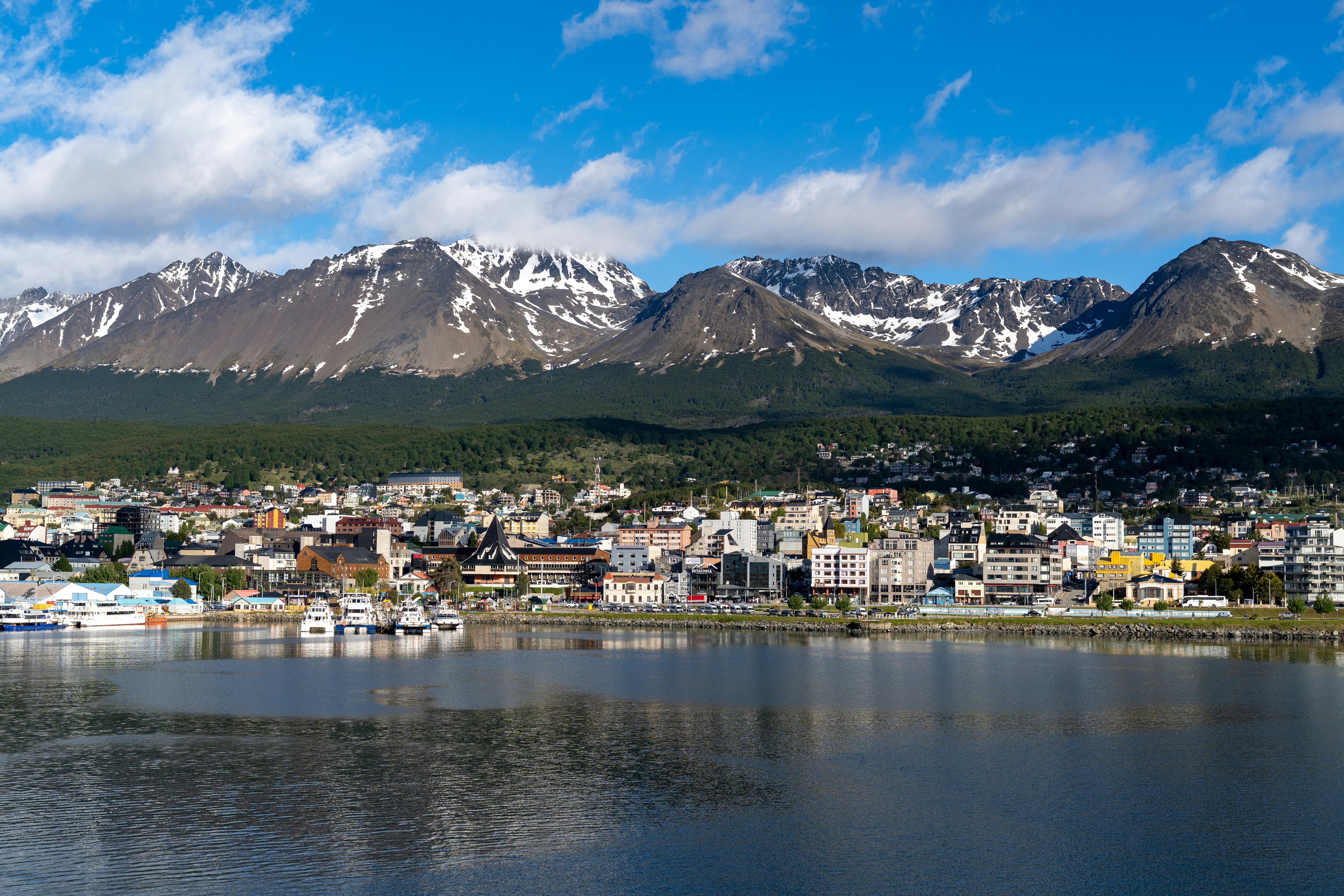
Polar expedition image for Ushuaia

Note 03

Gateway port · Beagle Channel

Ushuaia

The “end of the world” departure point where classic Antarctic voyages begin.

Polar expedition image opening the Ushuaia field note

Polar field dossier

The “end of the world” departure point where classic Antarctic voyages begin.

Gateway port · Beagle Channel

Ushuaia

Ushuaia is well known because it serves as the main departure point for Antarctic expeditions and cruise ships heading toward the Antarctic Peninsula. From here, vessels cross the famous Drake Passage, making it the starting point of almost every classic Antarctic journey. The setting is already dramatic: mountains, glaciers, and the Beagle Channel create a feeling of being at the edge of the world.

Historically, Ushuaia was founded in the late 19th century as a remote settlement and penal colony. Its strategic location at the southern tip of South America made it important for maritime navigation, lighthouse operations, and later scientific and logistical support for Antarctic exploration. Over time, it evolved from a frontier outpost into a key hub for shipping, tourism, and research activity in the Southern Ocean.

Today, Ushuaia is known as the “end of the world” departure point — a place where modern Antarctic voyages begin, connecting travelers from civilization to one of the most remote regions on Earth.

Polar expedition image for Drake Passage

Note 04

Southern Ocean · Rite of passage

Drake Passage

The legendary ocean crossing between Cape Horn and Antarctica.

Polar expedition image opening the Drake Passage field note

Polar field dossier

The legendary ocean crossing between Cape Horn and Antarctica.

Southern Ocean · Rite of passage

Drake Passage

Drake Passage is the legendary stretch of ocean that separates South America (Cape Horn) from Antarctica, connecting the Atlantic and Pacific Oceans. It is one of the most famous—and most feared—sea routes in the world, known for its powerful currents, strong winds, and rapidly changing weather.

The Drake Passage is well known among explorers, sailors, and modern Antarctic travelers because it marks the gateway to the Antarctic continent. Most expeditions to the Antarctic Peninsula must cross it, and the journey has become almost symbolic: reaching Antarctica often begins with experiencing the Drake’s unpredictable conditions, sometimes called the “Drake Shake” when rough, or the “Drake Lake” when unusually calm.

Historically, the passage is named after Sir Francis Drake, the 16th-century English explorer who navigated the region during his circumnavigation of the globe. Although he likely did not intentionally pass through the exact waters now known as the Drake Passage, his voyage helped establish early European awareness of the southern seas. The passage itself was later formally identified as a key maritime route between the Atlantic and Pacific oceans.

Beyond its historical significance, the Drake Passage is also ecologically important. It is one of the most nutrient-rich marine environments on Earth, where the Antarctic Circumpolar Current circulates massive volumes of cold water around the continent. This supports an extraordinary abundance of marine life, including whales, seabirds, and krill, making it a crucial part of the Southern Ocean ecosystem.

Today, the Drake Passage remains both a rite of passage for Antarctic travelers and a vital natural corridor that shapes global ocean circulation and climate systems.

Polar expedition image for Port Charcot

Note 05

Booth Island · Heroic Age history

Port Charcot

A sheltered historic anchorage tied to Jean-Baptiste Charcot’s early Antarctic work.

Polar expedition image opening the Port Charcot field note

Polar field dossier

A sheltered historic anchorage tied to Jean-Baptiste Charcot’s early Antarctic work.

Booth Island · Heroic Age history

Port Charcot

Port Charcot is a sheltered bay located on the northwestern coast of Booth Island, within the striking landscapes of the Wilhelm Archipelago. Enclosed by steep snow-covered peaks and protected waters, it is one of the most historically significant landing sites in the region.

Port Charcot is best known for its strong connection to the early “Heroic Age” of Antarctic exploration. It was discovered and named during the French Antarctic Expedition of 1903–1905, led by explorer Jean-Baptiste Charcot. The expedition used this natural harbor as a wintering and scientific base, conducting some of the earliest systematic mapping, meteorological observations, and biological studies of the Antarctic Peninsula.

The site became an important point for early cartography of the region, helping to correct and expand knowledge of the complex island geography of the Wilhelm Archipelago. Charcot and his crew spent months in the area under extreme conditions, contributing significantly to the scientific understanding of Antarctica at the time.

Today, Port Charcot is also well known for its wildlife, particularly gentoo penguin colonies that nest among the rocky slopes above the bay. Visitors often experience a striking combination of historical significance and natural beauty — walking in the footsteps of early explorers while surrounded by glaciers, icebergs, and active Antarctic ecosystems.

Polar expedition image for Hervéou Port

Note 06

Pléneau Island · Ice and wildlife

Hervéou Port

A visually striking anchorage near the Lemaire Channel with ice, wildlife, and quiet water.

Polar expedition image opening the Hervéou Port field note

Polar field dossier

A visually striking anchorage near the Lemaire Channel with ice, wildlife, and quiet water.

Pléneau Island · Ice and wildlife

Hervéou Port

Hervéou Port is a sheltered anchorage located on Pléneau Island, in the picturesque waters of the Lemaire Channel region of the Antarctic Peninsula. Surrounded by towering ice cliffs, drifting icebergs, and quiet polar waters, it is considered one of the most visually striking stopping points for expedition cruises and private yacht voyages.

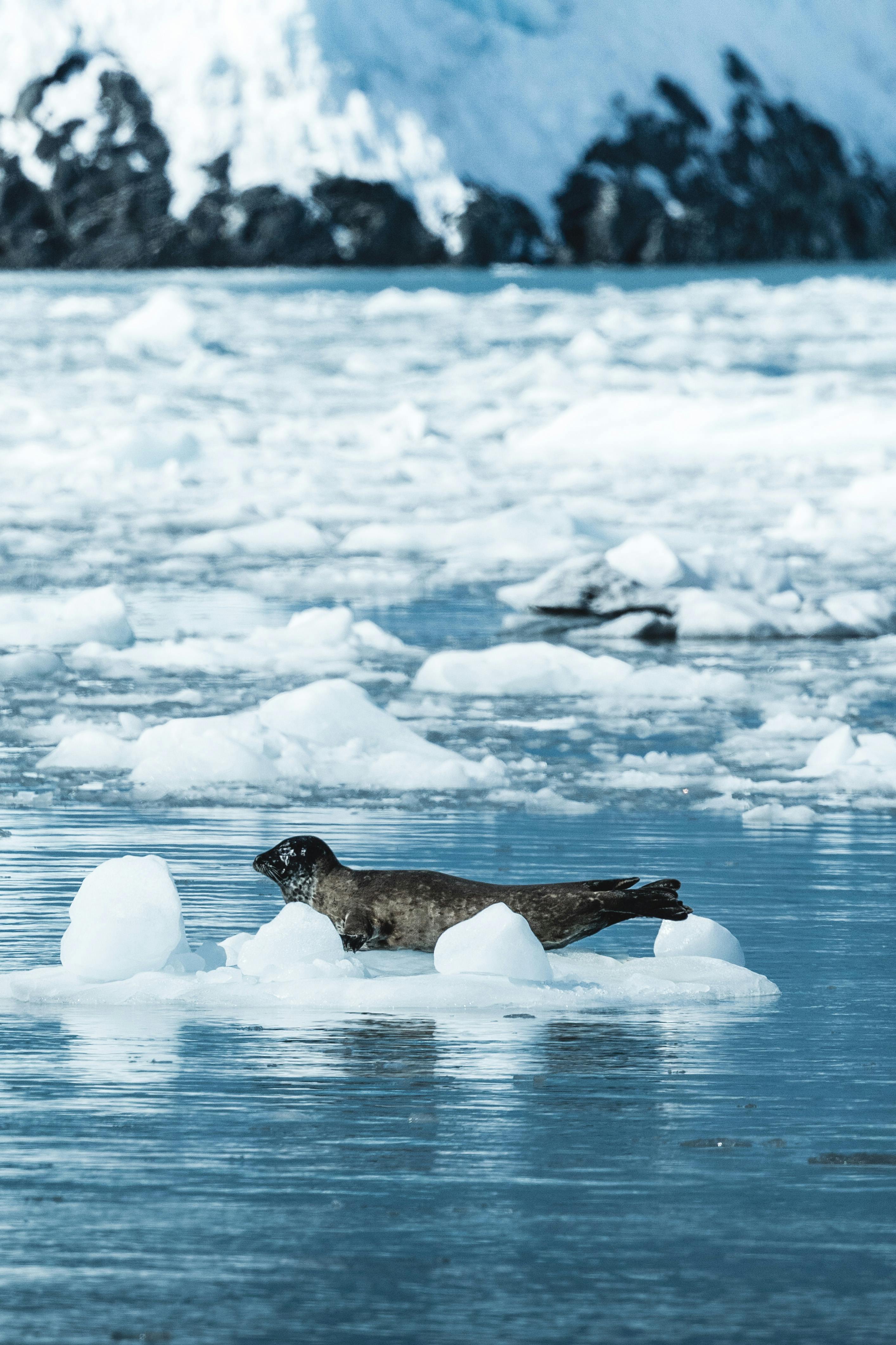
The area is well known for its exceptional wildlife encounters and dramatic scenery. Gentoo penguins are commonly seen along the rocky shores, while seals rest on floating ice and humpback whales often surface in the surrounding channels. The combination of calm anchorage conditions and dense wildlife activity makes Hervéou Port a favored landing and observation site for Antarctic expeditions.

Historically, Pléneau Island and its surrounding waters were explored during the early era of Antarctic charting in the late 19th and early 20th centuries, when Belgian and French expeditions mapped much of the Antarctic Peninsula. The name “Hervéou Port” reflects later French Antarctic exploration and surveying activity in the region, which contributed to more precise mapping of the complex island geography.

Polar expedition image for Port Lockroy

Note 07

Historic base · Antarctic post office

Port Lockroy

One of Antarctica’s most recognisable human landmarks, with history, penguins, and a working post office.

Polar expedition image opening the Port Lockroy field note

Polar field dossier

One of Antarctica’s most recognisable human landmarks, with history, penguins, and a working post office.

Historic base · Antarctic post office

Port Lockroy

Port Lockroy is one of the most famous historic sites on the Antarctic Peninsula, located on tiny Goudier Island near Wiencke Island. Surrounded by dramatic glaciers and icy mountain peaks, it is widely known as one of the most accessible and culturally significant locations in Antarctica.

Port Lockroy became famous during World War II, when the British established “Base A” there in 1944 as part of a secret military and scientific operation known as Operation Tabarin. The base was created to strengthen British presence in Antarctica and to conduct meteorological and scientific research in the region.

After the war, the station continued operating as a research base until it was eventually closed in the 1960s. Today, the restored buildings serve as a museum and post office, maintained by the UK Antarctic Heritage Trust. The site is home to one of the world’s southernmost post offices, allowing visitors to send postcards from Antarctica.

Port Lockroy is also well known for its large gentoo penguin colony, which lives alongside the historic buildings, creating one of the continent’s most iconic scenes. Strict environmental monitoring is conducted to ensure tourism does not disturb the wildlife.

Today, Port Lockroy stands as a symbol of Antarctica’s exploration history, scientific heritage, and international cooperation — combining polar history, wildlife, and spectacular scenery in one unforgettable destination.

Polar expedition image for Paradise Bay

Note 08

Glacier amphitheatre · Peninsula classic

Paradise Bay

A calm-water Antarctic icon known for glaciers, reflections, whales, and scale.

Polar expedition image opening the Paradise Bay field note

Polar field dossier

A calm-water Antarctic icon known for glaciers, reflections, whales, and scale.

Glacier amphitheatre · Peninsula classic

Paradise Bay

Paradise Bay is one of the most breathtaking and iconic destinations along the Antarctic Peninsula, renowned for its calm waters, towering glaciers, and mirror-like reflections of icebergs and snow-covered mountains.

The bay is especially well known for its extraordinary scenery and abundant marine wildlife. Humpback whales, seals, penguins, and seabirds are frequently spotted in the area.

Paradise Bay was named by early whalers and explorers who were struck by the area’s remarkable beauty and natural shelter. During the early 20th century, the bay became an important anchorage for ships navigating the Antarctic Peninsula due to its relatively calm conditions and protected geography.

The region also reflects Antarctica’s transition from exploration to scientific research. Today, research stations operated by Argentina and Chile are located along the bay, contributing to ongoing studies of glaciology, marine ecosystems, and climate science.

Polar expedition image for Cuverville Island

Note 09

Errera Channel · Gentoo colony

Cuverville Island

A steep-sided island known for one of the Peninsula’s largest gentoo penguin colonies.

Polar expedition image opening the Cuverville Island field note

Polar field dossier

A steep-sided island known for one of the Peninsula’s largest gentoo penguin colonies.

Errera Channel · Gentoo colony

Cuverville Island

Cuverville Island is a small steep-sided island located in the Errera Channel between the Antarctic Peninsula and Rongé Island. Surrounded by towering glaciers and drifting icebergs, it is considered one of the most scenic and photogenic destinations in Antarctica.

The island is especially well known for hosting one of the largest gentoo penguin colonies on the Antarctic Peninsula. Thousands of penguins nest along its rocky shores during the breeding season, while humpback whales, seals, and Antarctic seabirds are frequently seen in the surrounding waters. The combination of abundant wildlife and dramatic polar scenery has made Cuverville Island one of the highlights of Antarctic expedition cruises and yacht voyages.

Historically, the region was explored during the late 19th century by the Belgian Antarctic Expedition led by Adrien de Gerlache, one of the pioneering scientific expeditions to Antarctica. The island was named after Jules de Cuverville, a French naval officer, reflecting the era of early European exploration and charting of the Antarctic Peninsula.

Polar expedition image for Gouvernøren Harbour

Note 10

Enterprise Island · Whaling wreck

Gouvernøren Harbour

A haunting historic harbour marked by the remains of the Norwegian factory ship Governoren.

Polar expedition image opening the Gouvernøren Harbour field note

Polar field dossier

A haunting historic harbour marked by the remains of the Norwegian factory ship Governoren.

Enterprise Island · Whaling wreck

Gouvernøren Harbour

Gouvernøren Harbour is one of the most intriguing historic sites along the Antarctic Peninsula, located near Enterprise Island in Wilhelmina Bay. The harbour is best known for the dramatic wreck of the Norwegian whaling ship Governoren, whose remains still lie partially submerged in the icy waters.

Built in 1915, the Governoren was one of the largest factory ships operating during the Antarctic whaling era. In 1916, while anchored at Enterprise Island, a fire broke out onboard after whale oil ignited during processing operations. To prevent the flames from spreading and causing a catastrophic explosion, the crew deliberately ran the ship aground in the harbour. Remarkably, all crew members survived.

Today, the rusting remains of the vessel have become one of Antarctica’s most iconic historical landmarks, offering a rare and haunting reminder of the continent’s industrial whaling past. The wreck, surrounded by glaciers, icebergs, and calm polar waters, creates a striking contrast between human history and Antarctica’s untouched wilderness.

Polar expedition image for Mikkelsen Harbour

Note 11

Trinity Island · Calm anchorage

Mikkelsen Harbour

A sheltered harbour with glaciers, wildlife, and traces of early polar presence.

Polar expedition image opening the Mikkelsen Harbour field note

Polar field dossier

A sheltered harbour with glaciers, wildlife, and traces of early polar presence.

Trinity Island · Calm anchorage

Mikkelsen Harbour

Mikkelsen Harbour is a sheltered natural harbour located between Trinity Island and the Antarctic Peninsula, known for its calm waters, dramatic ice-covered scenery, and rich Antarctic wildlife. Surrounded by towering glaciers and floating icebergs, it is considered one of the most scenic anchorages in the region.

The harbour is especially well known for its colonies of gentoo penguins and frequent sightings of seals and whales, making it a popular stop for expedition yachts and polar voyages.

Mikkelsen Harbour was named after the Danish explorer and polar captain Ejnar Mikkelsen, who contributed significantly to Arctic and Antarctic exploration during the early 20th century. The area became known during the era of Antarctic exploration and whaling, when ships navigated the surrounding waters in search of safe anchorages and access to remote coastal regions.

Today, one of the harbour’s most notable historic features is a small abandoned Argentine refuge hut, which stands as a reminder of the early scientific and exploratory presence in Antarctica. The combination of pristine scenery, wildlife, and traces of polar history has made Mikkelsen Harbour one of the memorable destinations along the Antarctic Peninsula.

Polar expedition image for Deception Island

Note 12

Volcanic caldera · Port Foster

Deception Island

A flooded active volcano with black beaches, geothermal heat, and whaling ruins.

Polar expedition image opening the Deception Island field note

Polar field dossier

A flooded active volcano with black beaches, geothermal heat, and whaling ruins.

Volcanic caldera · Port Foster

Deception Island

Deception Island is one of the most unique and historically important destinations in Antarctica. The island is actually the flooded caldera of an active volcano, creating a natural harbor at its center known as Port Foster. Ships enter through a narrow passage called Neptune’s Bellows, one of the most dramatic entrances in the Antarctic region.

Deception Island is well known for its volcanic landscape, black sand beaches, steaming geothermal areas, and the rare opportunity to experience warm volcanic waters in Antarctica. The contrast between fire and ice makes it one of the continent’s most visually striking locations.

The island also holds a remarkable history. During the early 20th century, Deception Island became one of the most important whaling centers in Antarctica. Remains of abandoned whaling stations, fuel tanks, boats, and buildings can still be seen today, particularly at Whalers Bay, offering a powerful glimpse into Antarctica’s industrial past.

Later, the island was used by British, Chilean, and Argentine research stations until volcanic eruptions in 1967 and 1969 caused significant destruction and forced several bases to be evacuated. The volcanic activity reshaped parts of the island and added to its reputation as one of Antarctica’s most extraordinary natural environments.

Polar expedition image for Hannah Point

Note 13

Livingston Island · Protected wildlife

Hannah Point

A biologically rich landing site protected for its dense Antarctic wildlife.

Polar expedition image opening the Hannah Point field note

Polar field dossier

A biologically rich landing site protected for its dense Antarctic wildlife.

Livingston Island · Protected wildlife

Hannah Point

Hannah Point is one of the most biologically rich and carefully protected landing sites in the South Shetland Islands, located on the southern coast of Livingston Island. It is widely known for its extraordinary concentration of Antarctic wildlife and dramatic coastal scenery.

The site is especially famous for its large colonies of gentoo and chinstrap penguins, southern giant petrels, elephant seals, and fur seals. Because of its exceptional ecological importance and biodiversity, Hannah Point is designated as an Antarctic Specially Protected Area (ASPA), with strict visitor regulations in place to preserve its fragile environment.

Historically, the waters around Livingston Island were among the first areas explored by sealers following the discovery of the South Shetland Islands in 1819. During the early 19th century, seal hunters arrived in large numbers, making this region one of the earliest centers of human activity in Antarctica. While Hannah Point itself is primarily known today for wildlife rather than historic structures, it remains part of that important early chapter in Antarctic exploration.

Polar expedition image for Half Moon Island

Note 14

Crescent island · Chinstrap penguins

Half Moon Island

A small crescent-shaped island with volcanic forms, penguins, seals, and open views.

Polar expedition image opening the Half Moon Island field note

Polar field dossier

A small crescent-shaped island with volcanic forms, penguins, seals, and open views.

Crescent island · Chinstrap penguins

Half Moon Island

Half Moon Island is a small crescent-shaped island located between Livingston Island and Greenwich Island in the South Shetland archipelago. Known for its dramatic volcanic landscapes, black rock beaches, and rich wildlife, it is considered one of the most picturesque landing sites in Antarctica.

The island is especially famous for its large chinstrap penguin colonies, as well as frequent sightings of Weddell seals, elephant seals, and Antarctic seabirds. Its relatively calm landing conditions and stunning panoramic views have made Half Moon Island a popular destination for expedition yachts and polar voyages.

Historically, the surrounding waters were explored extensively during the early 19th century by sealers and navigators following the discovery of the South Shetland Islands in 1819. Like many locations in the region, Half Moon Island became part of the wider sealing era that marked the beginning of human activity in Antarctica.

Today, the island also hosts the seasonal Argentine research station Camará, established in the 1950s, reflecting Antarctica’s transition from exploration and resource exploitation to scientific cooperation and environmental protection.

Polar expedition image for Yankee Harbour

Note 15

Greenwich Island · Sealing history

Yankee Harbour

A protected natural harbour with early sealing history, wildlife, and calm landing conditions.

Polar expedition image opening the Yankee Harbour field note

Polar field dossier

A protected natural harbour with early sealing history, wildlife, and calm landing conditions.

Greenwich Island · Sealing history

Yankee Harbour

Yankee Harbour is one of the most historic natural harbours in the South Shetland Islands, located on Greenwich Island off the Antarctic Peninsula. Sheltered by dramatic mountains and glaciers, the harbour became a key anchorage for American and British sealing ships in the early 19th century.

Its name dates back to the era when “Yankee” sealers — primarily from New England in the United States — traveled to Antarctic waters in search of fur seals. During the sealing boom of the 1820s, Yankee Harbour served as an important base for hunting operations, repairs, and temporary camps. The intense exploitation of seal populations during this period became one of the earliest chapters of human activity in Antarctica.

Today, the harbour is well known not only for its history, but also for its remarkable wildlife and scenery. Visitors often encounter gentoo penguin colonies, elephant seals resting along the shore, and seabirds soaring above the icy coastline. The combination of historical significance, protected natural beauty, and calm landing conditions has made Yankee Harbour a favorite stop for Antarctic expeditions and yacht voyages.

The site remains protected under the Antarctic Treaty System as an area of historic and environmental importance, preserving the legacy of Antarctica’s earliest explorers and seal hunters.

Polar expedition image for Fort Point

Note 16

Greenwich Island · Historic Site

Fort Point

A South Shetlands landing with early sealing remains, wildlife, and protected heritage.

Polar expedition image opening the Fort Point field note

Polar field dossier

A South Shetlands landing with early sealing remains, wildlife, and protected heritage.

Greenwich Island · Historic Site

Fort Point

Fort Point is one of the most historically significant sites in the South Shetland Islands, located on Greenwich Island near the Antarctic Peninsula. The area is especially known for its connection to the early 19th-century sealing industry, when Antarctic waters attracted seal hunters from Britain, the United States, and other maritime nations.

Fort Point became an important shelter and operating area for sealers during the 1820s, at the height of the Antarctic fur seal trade. The remains of stone refuges and primitive structures built by these early expeditions can still be found there today, offering a rare glimpse into the harsh realities of the first human activity in Antarctica.

The site is also recognized for its exceptional wildlife. Large colonies of gentoo penguins, elephant seals, and numerous seabirds inhabit the surrounding coastline, making Fort Point both historically and ecologically important.

Today, Fort Point is protected under the Antarctic Treaty System as a Historic Site and Monument, preserving its archaeological remains and cultural heritage. It stands as a reminder of the earliest era of Antarctic exploration — long before scientific stations and modern expeditions reached the continent.